Categories
2024
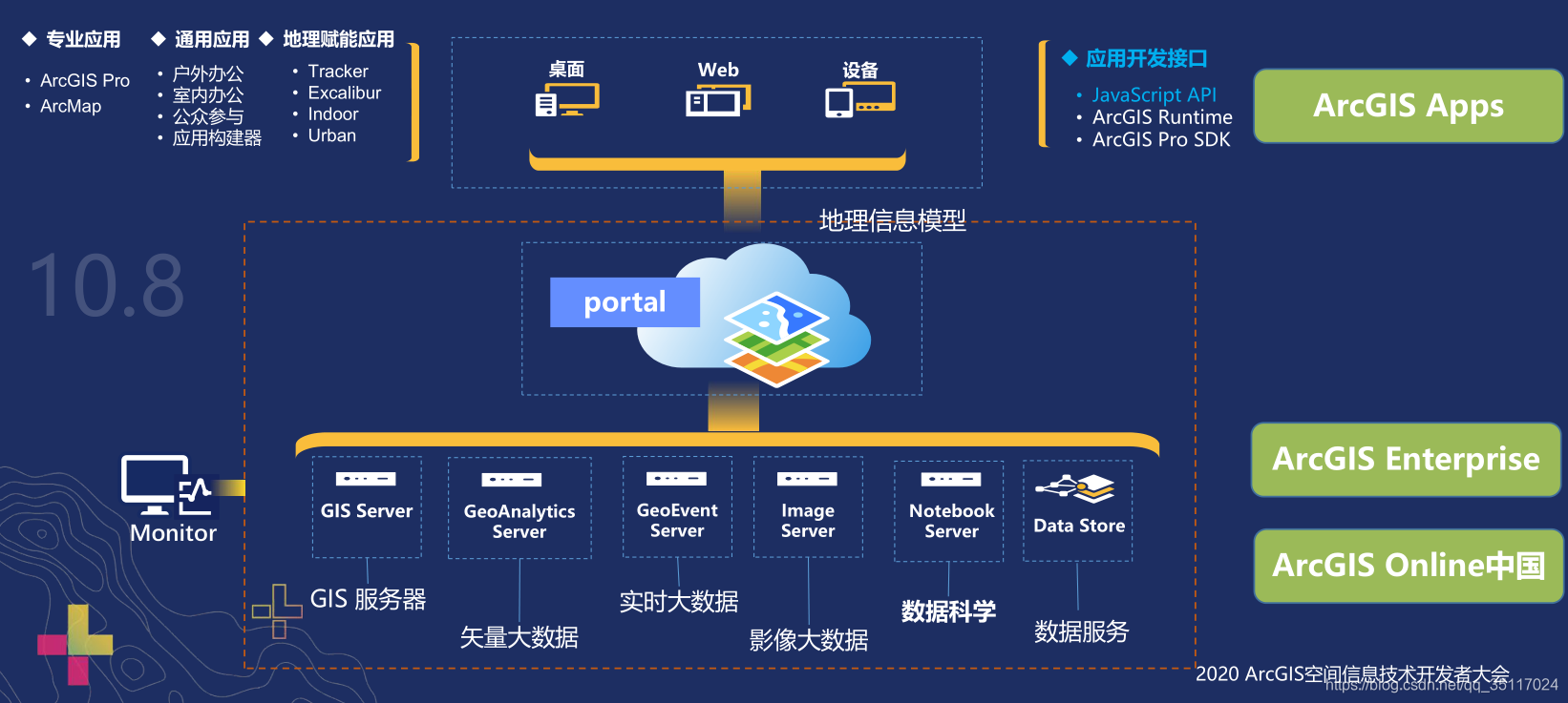
认识 ArcGIS Maps SDK for JavaScript
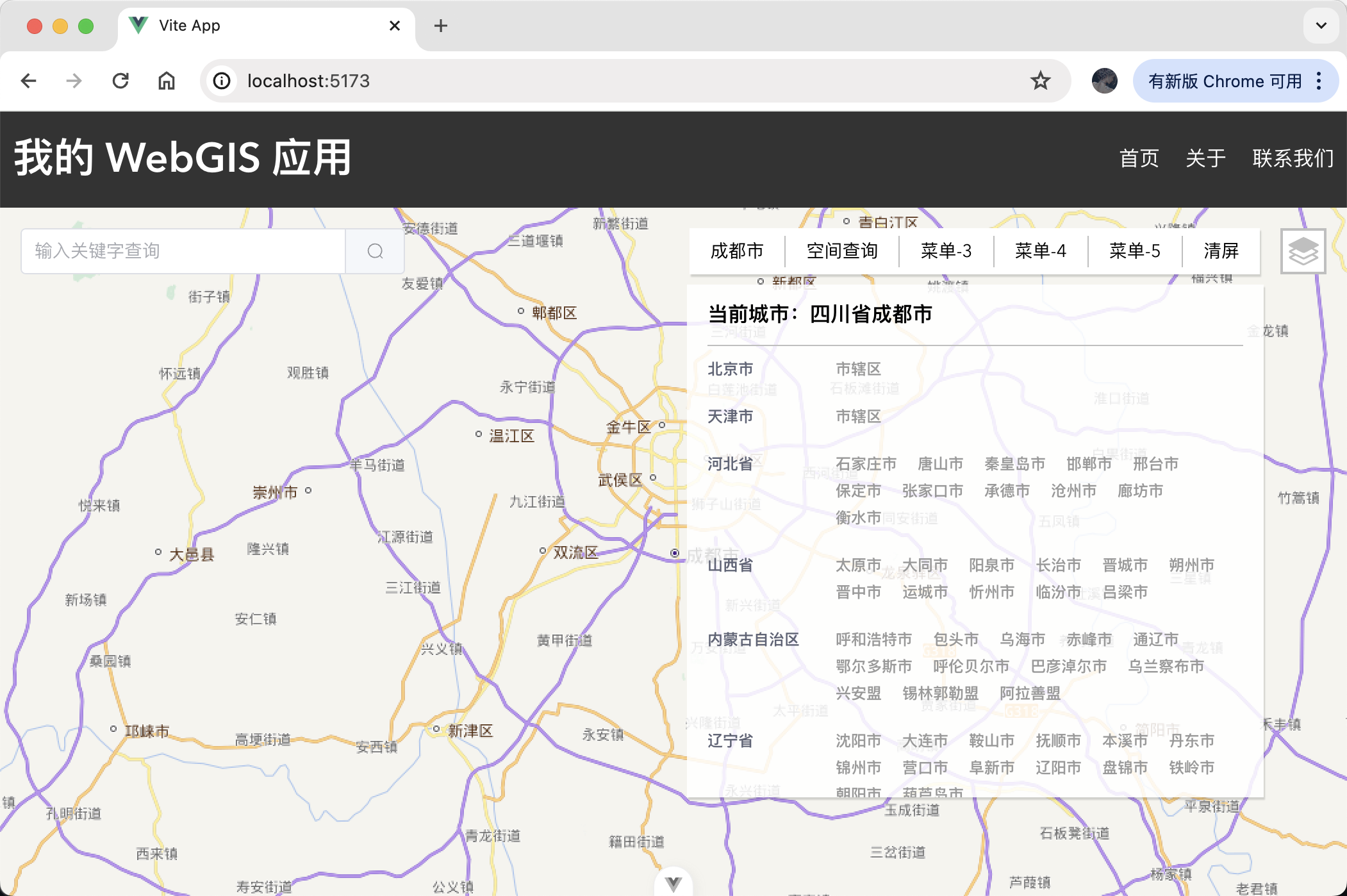
行政区划模块实现指南
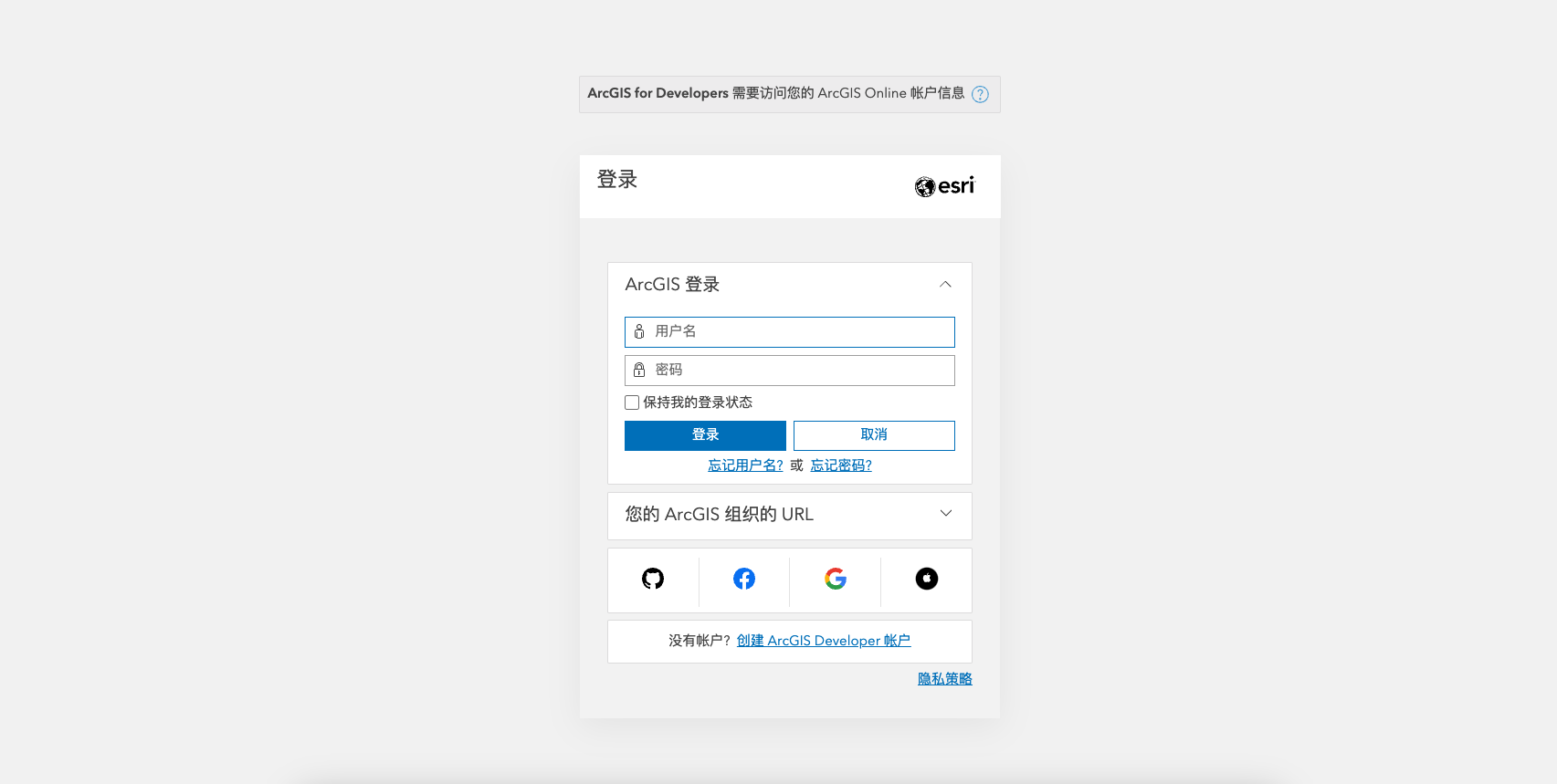
注册 ArcGIS 开发者账号:开始您的 WebGIS 之旅
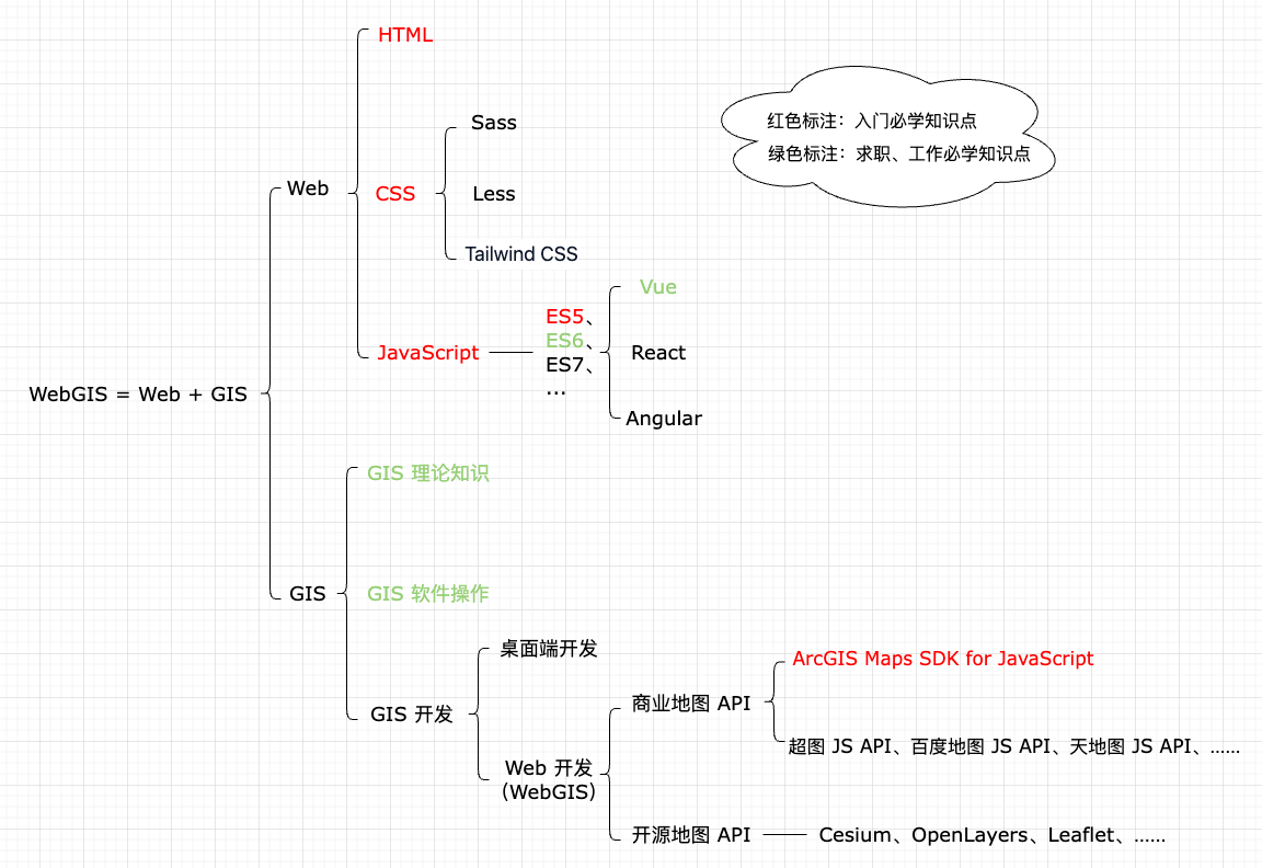
欢迎来到 WebGIS 开发世界
搭建 WebGIS 开发环境:一步步指南
探索 ArcGIS Maps SDK for JavaScript 的奥秘
掌握地图显示控制技巧:打造独特的 WebGIS 地图界面
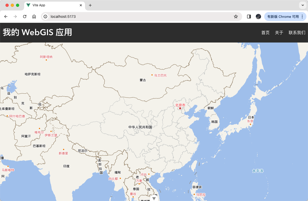
快速上手:使用 Vue 3 创建您的第一个 WebGIS 地图

地理信息查询之空间查询

地理信息查询之属性查询

图层操作指南:添加、搜索、移除与图层管理

从点选到缓冲区分析:掌握 WebGIS 的空间分析技巧

与地图互动:全屏、底图切换、二三维视图切换实现

下一步学习与进阶建议:拓展您的 WebGIS 技能与视野

WebGIS 数据可视化:热门图表库的使用

WebGIS 开发入门系列总结与学习心得
WebGIS 从前端到后端:后台接口开发
